|
|
|
|
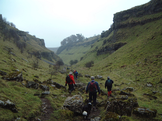
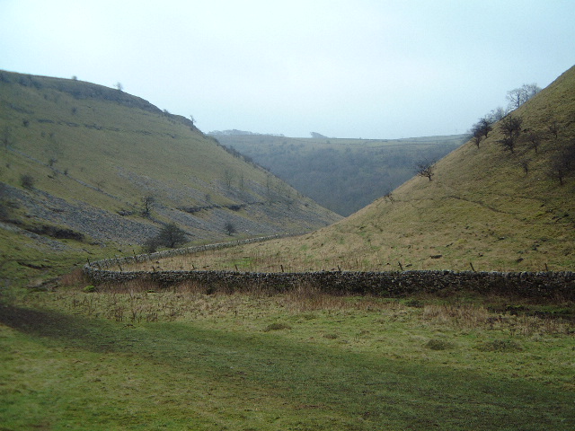
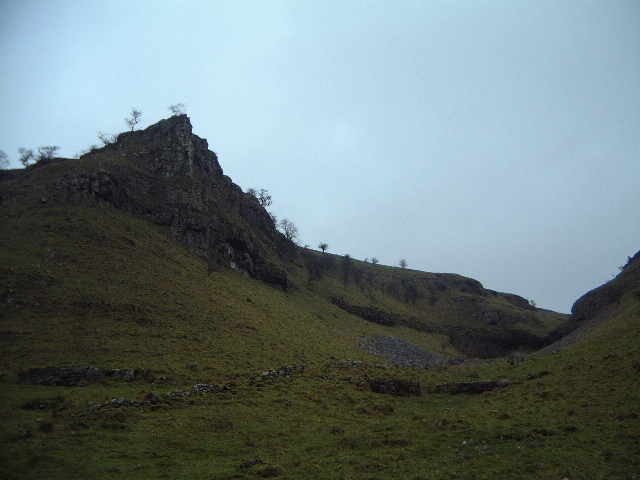
6 January I went out with the Ramblers. We did 8 miles around Sandon , Fradswell and Gayton returning via Sandon Hall and the canal. I was talking a lot and not taking much notice and it was also foggy so I can't say much much. However after a period of relative inactivity (visiting relatives at Christmas) it was good to get the boots on again and do a reasonable distance. 13 January For a change I went out with Stone Ramblers. SRG only had a morning walk walk, which Beryl went on. I felt I needed more exercise and we'd heard from Maggie and Stuart that this would be a strong walk. It certainly did live up to promises. By the end several people had felt the need to point out to me that the group didn't normally walk at the speed we were doing. But they all knew the leader and judged whether they were capable of hwat hhe'd be doing. What he did do was 12.25 miles in 4.5 hours and I uspect from the fairly casual way he was walking that he was holding himself back. The walk was an end-to-end one from Moneyash to Biggin. Well, actually it was half of a circuit that the Long Distance Walkers Association do (they're deranged). It went down Lathkilldale, up Bradforddale and then climbed across Gratton and up Long Dale. A section of road walking to the A515 at Newhaven and then into Biggin. Back to Moneyash for a welcome cup of tea, although not the customary ice cream. I'd walked most of it before, although not as a single walk. It was still a good day. I didn't have much chance to take photos - it was too much like hard work having to catch up but here are some shots of Lathkilldale.
My walk around Nescliffe for SRG; very much as prewalked on 15 December 2001. There's a full description there. It's been pretty wet since I did that prewalk and the fields were muddier than they had been - especially those ploughed up in the interim. In fact the only thing muddier was my name. It also rained for much of the morning too. I did make one concession, skirting around the south and east of Little Ness along the road. There were still lots of gloomy faces at lunch. After hat things improved. The paths became firmer, the scenery got better and the weather was almost sunny for a short while. So I retrieved a few points especially along the ridge of Nesscliffe. It was a case of good planning because I'd saved the best until last. 27 January Out walking on my own again but on paths I’ve not walked before. Actually on a sunny day in the middle of a dry spell it would have been a really good walk, showing off the rolling hills of Shropshire. Instead I had mud sticking to my feet for much of the day and the rain set in at 11:30. Many of the fields had been ploughed probably at the back end of last year and they hadn’t yet bound back together into a solid surface. To make matters worse my legs felt really heavy, right from the start of the walk. So it was a day of walking for fitness rather than real pleasure and I walked reasonably quickly – just over 11.5 miles in 4.75 hours including map-reading. I parked on the edge of Much Wenlock in the Wenlock Edge
car park; amazingly this was free, even though the car park is owned by the
National Trust. I walked back into town on the Shropshire Way. Then I took the
first footpath south from the Shrewsbury-Bridgnorth road and went quickly off to
the left and across a big soggy
field and crossed the back road to Craven Arms. I then had a long pull up a
green lane over an unnamed hill. When this lane ran out, I was briefly puzzled
about the direction before I found a finger (well away from any road): this
pointed across a large, recently ploughed field which was really hard work. A bit of relief then as I picked up a lane and wandered downhill to
Callaughton. I turned left at the stables down a short lane and through a wood,
before I forked left and followed the brook almost all the way to Muckley. I
left this path by turning right over the footbridge and climbing the hill in to
Acton Round. I walked past then
church and then left the lane going through Acton Round Coppice (which was very
pleasant) to Spoonhall Farm and then across some boggy fields to Bourton. From Bourton I took the north-west path past the Ark (a
barn) and got lost just beyond Black Barn Farm. There is a field boundary that
isn’t on the OS map, which is strange seeing as it is a belt of established
conifers. Still I worked my way around that and got myself back on to the
Shropshire Way. I then followed this all the way back to the car, mainly along
the final section of Wenlock Edge. It’s not the highest section and it’s
certainly not the prettiest section. The first part is a track and then you
climb up a really slithery back (I wouldn’t fancy coming down it at the
moment) to pick up a more interesting path at the top of a series of quarries. There was a final indignity at the end of a very muddy
walk. The path became a real bog. There were notices saying that there had been
some sort of motoring event there on the previous weekend. You could see how
this had churned up the path. For all the moans about the state of the paths, this is potentially a good walk. I’ll probably put it on a Ramblers programme but for the summer.
|
|